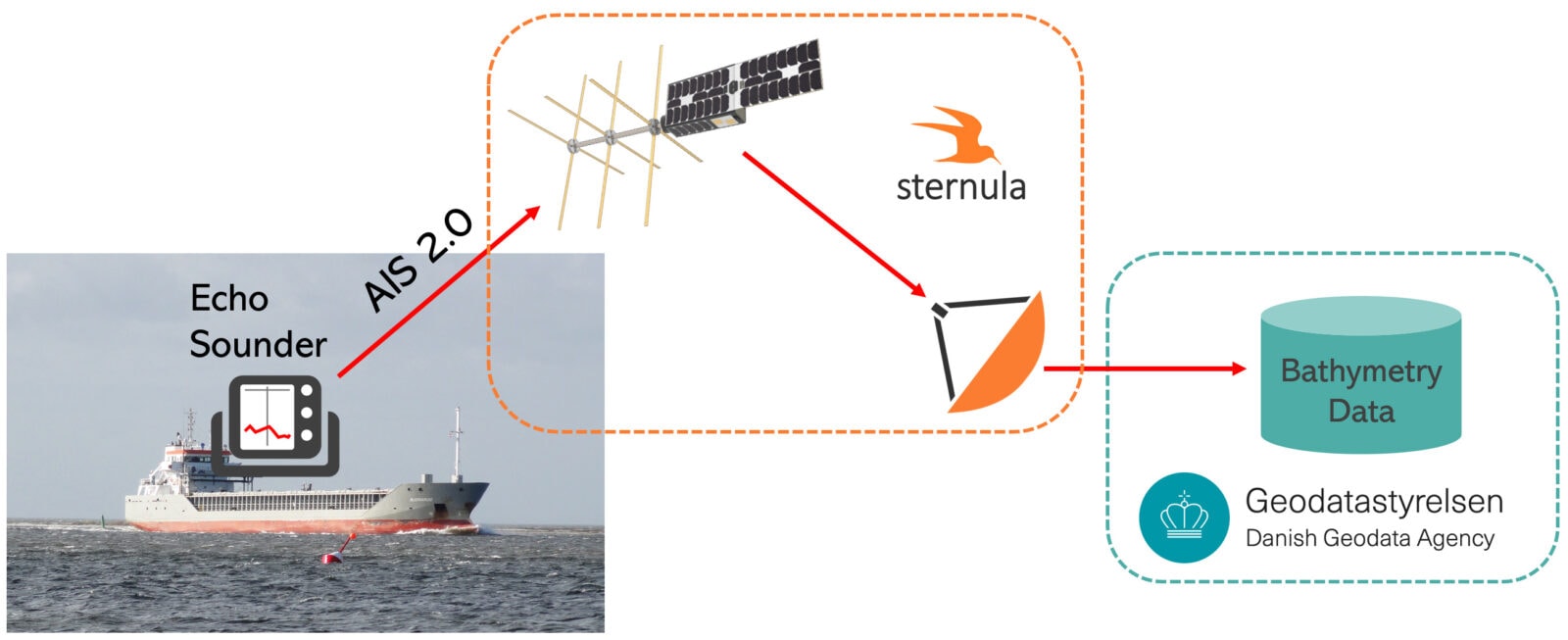
In a new collaboration project, the Danish Geodata Agency and Sternula will develop a solution for more effective production of sea maps by exploiting existing echo sounders onboard ships. AIS 2.0 as well as other available telecommunications technologies shall be used to transport seafloor data to the maps authority.
We are very happy to start working with the Danish Geodata Agency on crowd-sourced bathymetry. This is a typical digital service, which fits our AIS 2.0 network really well. The low cost per ship is essential for the agency to get many installations deployed. The concept used in this project is based on the VDES Living Lab project that we just completed. We are very happy that the innovation from that project can be converted to commercial applications with a limited overhead, says Lars Moltsen, CEO at Sternula.
At the Danish Geodata Agency, we aim to exploit new technology to do things smarter. Sternula offers a new solution for maritime connectivity, which allows us to provide a simple and effective solution that can extract bathymetric data from a network of sailing vessels at the same time. The Gavia project will develop a Truested CSB (Crowd-Sourced Bathymetry) platform that we will use to improve our nautical charts for many different regions, states Niels Tvilling Larsen, Head of Department, Danish Hydrographic Office at Danish Geodata Agency.
Read the press release here: