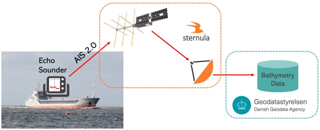
The aim of this project is to develop a solution for crowd-sourced seafloor mapping (Crowd-Sourced Bathymetry – CSB) that will provide the maritime industry with better sea maps. The solution takes advantage of the fact that the majority of fishing boats have precise echo sounders, which can produce useful samples of the water depth in the area where the boat is sailing.
Additionally, it makes use of the new Sternula‘s AIS 2.0 (VDES) data transport option, which is available by satellite, coastal VHF radio, and other connectivity options such as mobile networks in near-shore areas. The responsible maps authority can have access to significant volumes of data for sea map development by using a technology that can be put aboard many fishing vessels at a low cost.
The service is targeted at the global authorities responsible for producing nautical charts, the so-called National Mapping Agencies (NMA). In the Danish Geodata Agency (DGA), Sternula has an already-signed-up customer who have ordered the development of a generic platform for their open-source prototype CSB (Crowd-Sourced bathymetry) software solution GAVIAN.
Since fishing vessels typically do not follow the same sailing routes, the data that is collected will be more useful for bathymetric purposes. For CSB, scale is crucial since there are many active fishing vessels. They would agree to upgrade their ship’s AIS equipment in exchange for installing bathymetry data collection equipment on the ship to help map authorities.

In the suggested solution, periodic reports of data are continuously transmitted via AIS 2.0, especially when the data is classified as “urgent” or “sensitive”. Larger volumes of data can be retrieved in the future when high-data rate connectivity is available.
A scalable data collection platform for ships is provided as part of the value proposition, along with a global data connection via Sternula’s satellites.
The use of satellite connection can be crucial for cases where measured data is critical for navigational safety. Only satellite communication can provide a robust and reliable route to transport these data since the solution is focused on remote waters, where connectivity is frequently an issue.
The cost of implementation will be reduced in the future when VDE satellite technology is used as some of the devices are expected to be already on board. The cost of one dedicated hydrographic survey could equip more than 30 vessels with necessary hardware, including the data transfer during the first year.
Nowadays, it can take up to one year for the bathymetry data to be implemented in sea maps, which results in inaccurate maps, since the seabed changes constantly. With Sternula’s solution, the crucial information can be available for mariners within days. Additionally, thanks to significantly increased number of vessels collecting the data, map authorities will have access to higher volumes of them, resulting in more and better-quality nautical charts.
The project was successfully finished in August 2023.

Danalien 1, 2 tv, DK-9000
Aalborg, Denmark